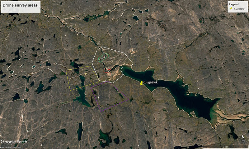
Welcome to Kuugaaluk
Summer, 2025 was the first season of collecting data at Kuugaaluk across four study topics which reflect the main concerns raised by Iqalungmiut and Panniqtuumiut in public engagement sessions so far.
This work supports a good understanding of current conditions, potential impacts if a water power project were built, and how we can minimize those impacts. All research was approved by relevant regulatory bodies. The consultants who completed this work were selected through a Request for Proposals process, with priority given to Inuit firms, firms with high Inuit employment, and local firms.
Explore each of the study topics further on the interactive maps below – there’s lots to learn!
Tip: These maps are best viewed on a tablet or laptop-sized screen.
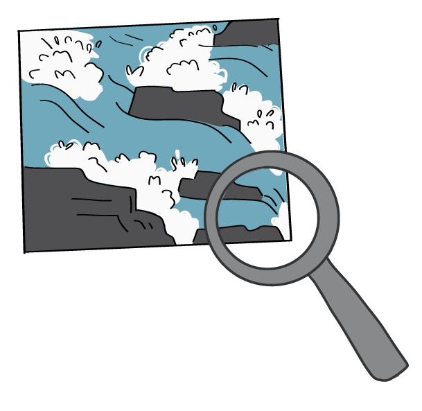
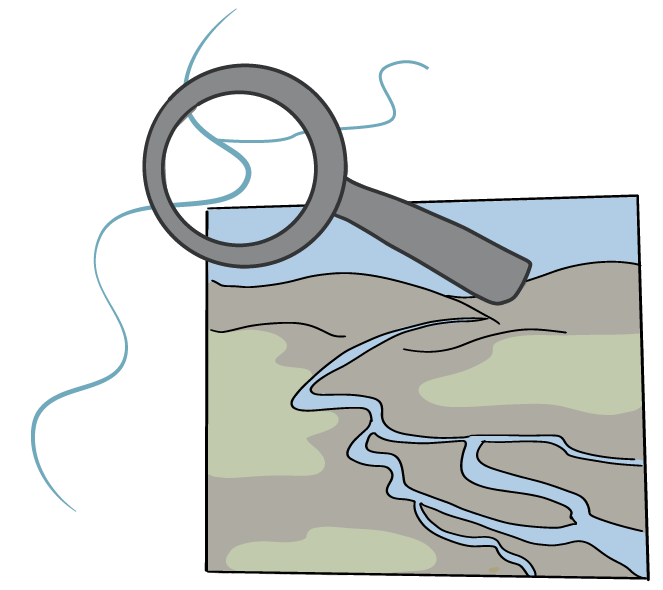
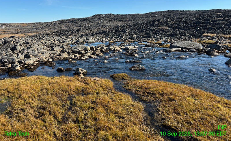
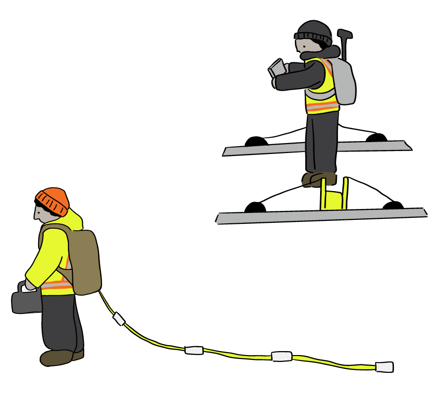
Aquatics
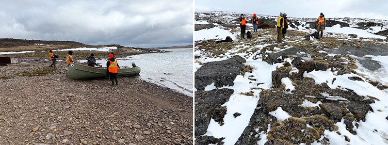
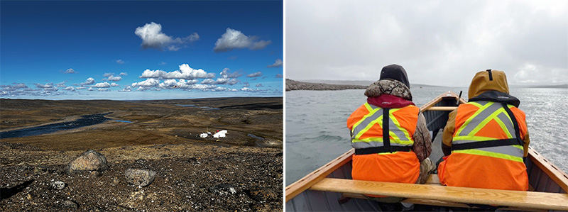
The Aquatics Team completed studies between August 25-26, 2025 for a total of 2 days. Dillon Consulting Ltd. and Inuit guides set out to learn about the freshwater environment in the Kuugaaluk river system.
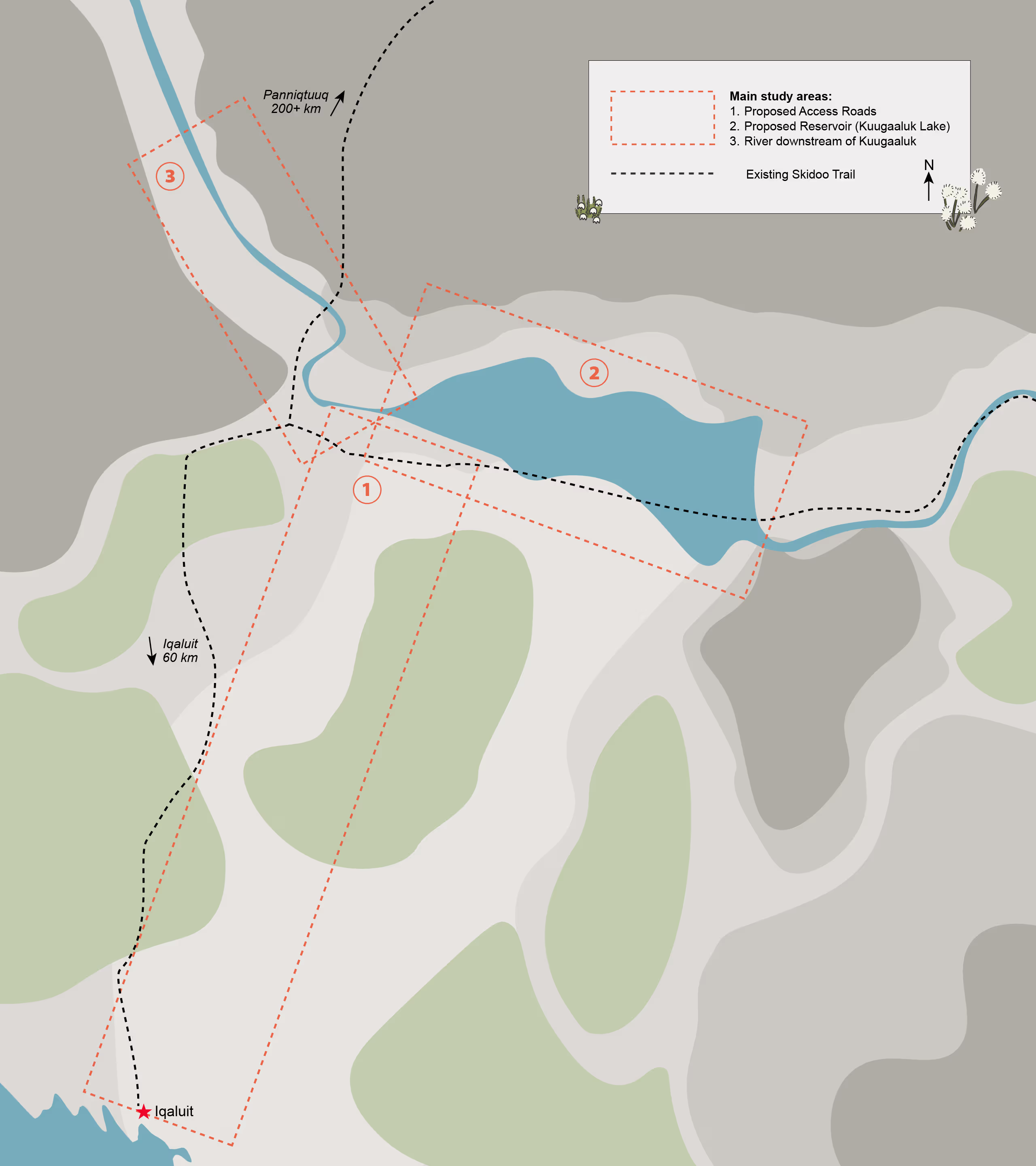
Surveys were done upstream and downstream of the proposed water power facility, at smaller nearby streams, and areas where an access road may go.
The information gathered is preliminary, meaning it gives us a basic picture of fish and their habitat today. This will help plan a bigger aquatics field program for 2026.
At this early stage, we can’t yet say how the proposed project might affect fish or fish habitat. More studies are needed.
Thank you to our crew and local Inuit knowledge holders who made this work possible.
- Click on the people and equipment to learn what the team did during the field season.
- Click on the magnifying glasses and other objects to see what was found.
- Click outside the text boxes to hide them again.
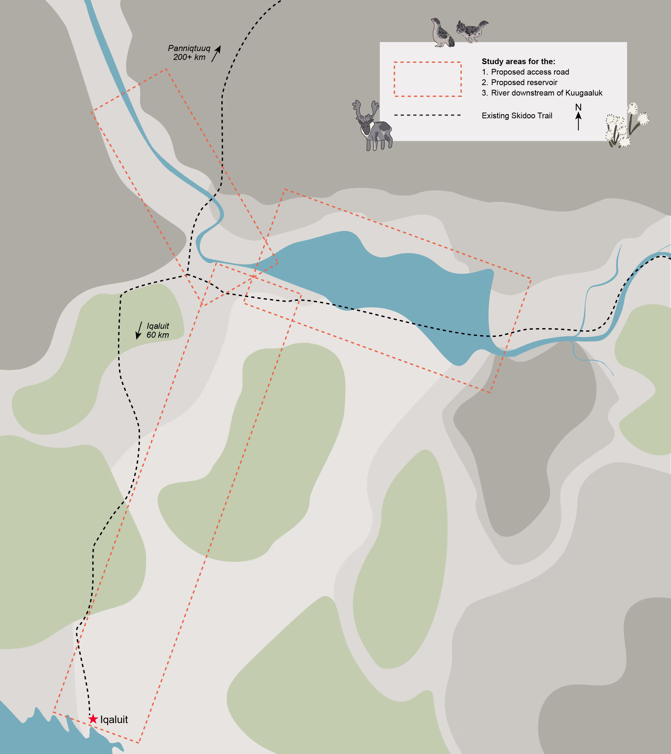
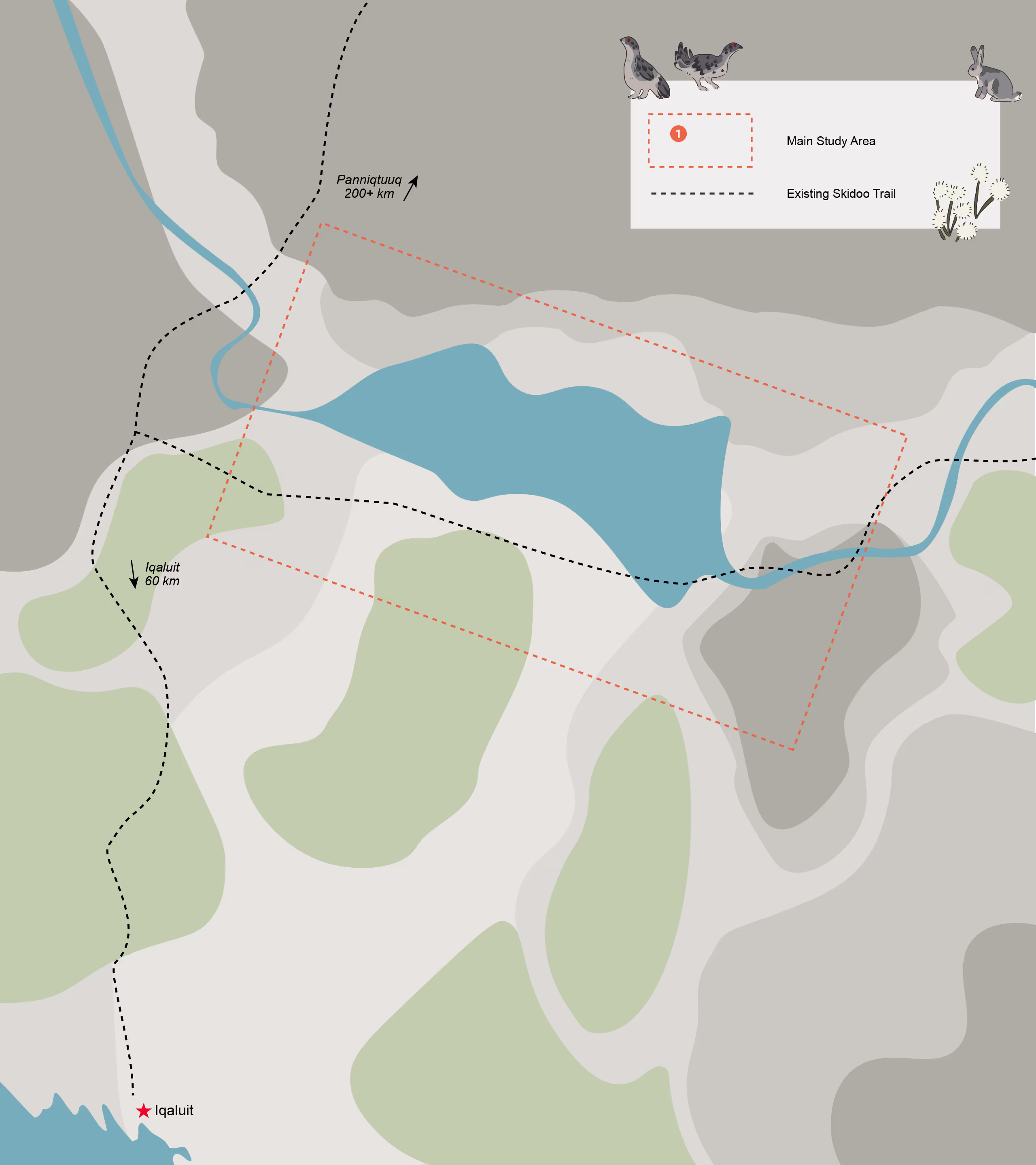
Proposed Access Road Study Area
The LiDAR maps were used to look at 59 places where streams or rivers cross the proposed access road route options.
Click on the LiDAR operator to learn more.

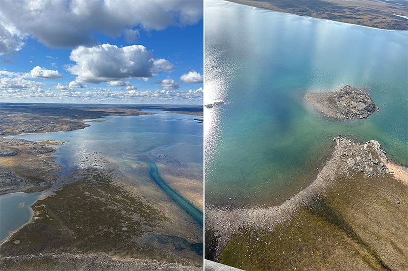
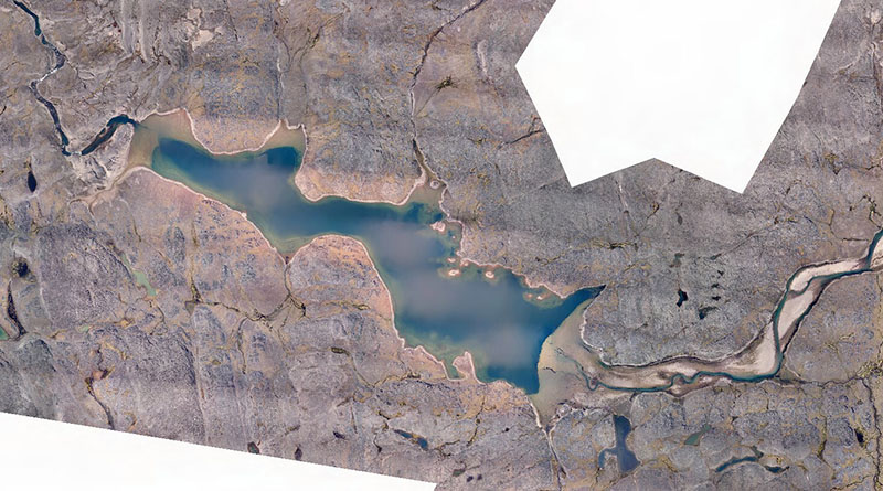
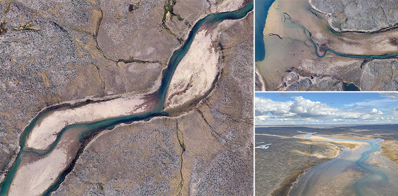
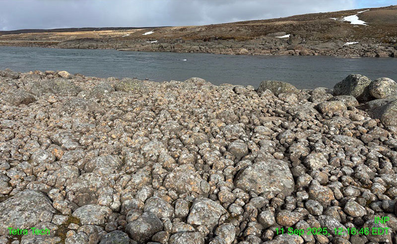
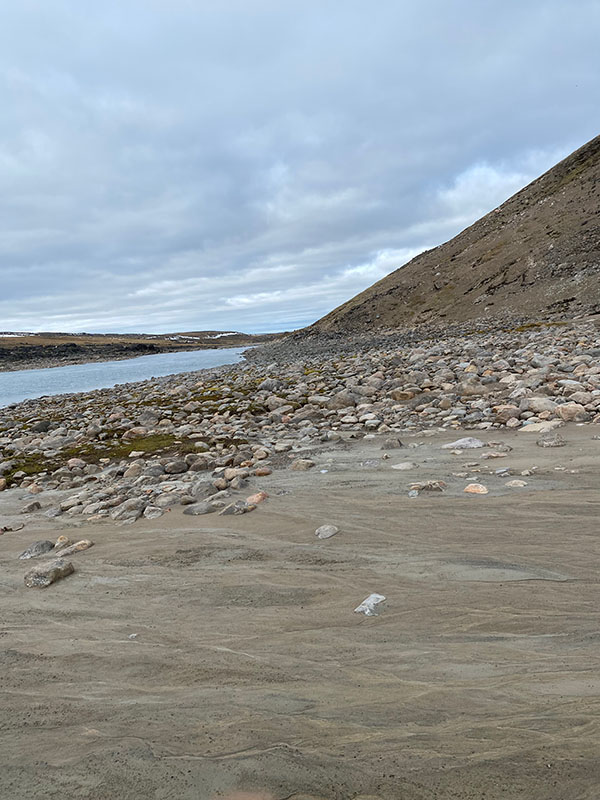
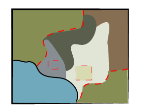
Existing Lake Shoreline – Preliminary Habitat Description
Most of the current lake shoreline is made up of rocky material, such as rubble and large boulders. Along the northeastern shoreline, there are shallow areas with gravel and small stones. These finer materials can provide good spawning habitat for Arctic Char.

Downstream of the Lake – Preliminary Habitat Description
Downstream of the proposed reservoir, the river mostly has rapids with large boulders making up most of the riverbed. Other types of river features were also seen, including pools, riffles, and shallow sections with smoother water.
Within the 100 km downstream area that was studied, there are places that can provide suitable habitat for Arctic Char at all stages of life.
Research
Scientists reviewed existing information to learn which fish species might live in the area and what their habitat is like. They looked at government reports, past environmental studies, and maps that show where fish are found.
This review helps describe the types of habitats in the area and how suitable they may be for different fish.
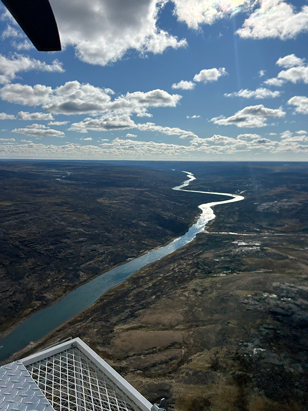
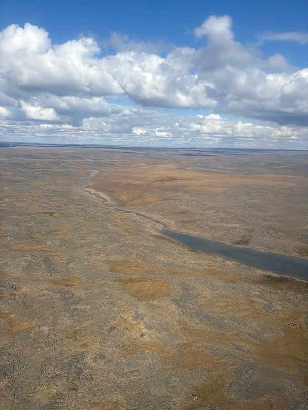
Looking from Above
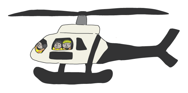
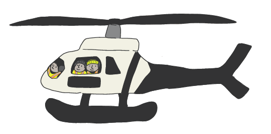
Scientists used helicopters to look at fish habitat from the air, along the lake’s shoreline at Kuugaaluk and up to 100 km downstream.
They made visual checks at 34 locations along the river to observe and record shoreline and water conditions.
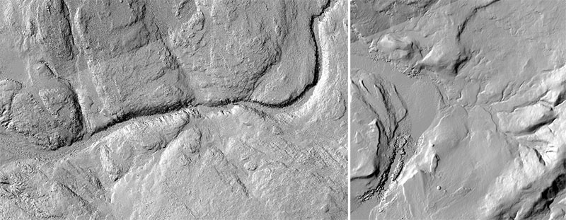
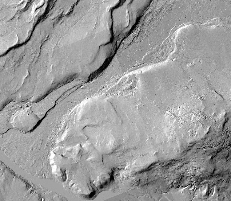
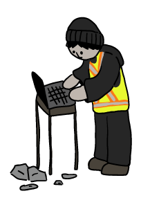
LiDAR Data Collection
A very detailed map of the project area was created using LiDAR.
LiDAR, which stands for Light Detection and Ranging, uses lasers to measure the shape of the land from above. This creates high-quality 3D maps of the ground.
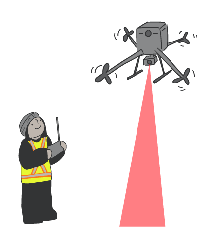
Arctic UAV, a company based in Iqaluit, flew drones over the area with the LiDAR equipment attached.
The LiDAR maps helped the team understand fish habitat in smaller streams upstream of the proposed reservoir, and at major river crossings along the proposed access road area.
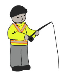
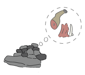
Fish Sampling
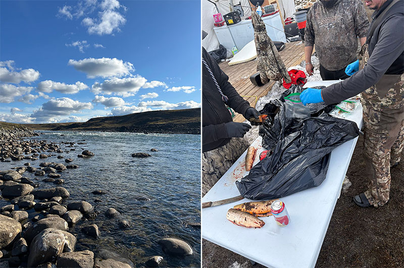
Local field crew members caught 28 fish at Kuugaaluk using fishing rods and lures. The fish species were identified and had their lengths measured.
Small samples from each fish were sent to a laboratory in St. John’s, NL. Testing helps scientists learn the age and growth rate of the fish. It also checks for mercury and other indicators that help explain what the fish eat and where they live.
Available Information
Background research of the Kuugaaluk River system found very few studies about fish and fish habitat in the area.
One fish study was done in 2019 for the nearby Chidliak mine project, about 48 km upstream from the proposed dam. In that study, Arctic Char was the only fish species found. All of the Arctic Char were young fish, with the largest one about 20 cm long.

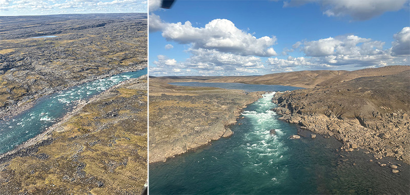
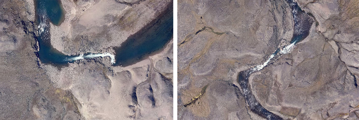
Upstream of the Lake – Preliminary Habitat Description
The proposed reservoir would flood about 20 km of the river upstream of the existing lake at Kuugaaluk. This part of the river would become more like a lake.
Most of this stretch is shallow with smooth, slow-moving water and a soft riverbed.
About 8 km upstream from the lake, scientists found 16 spots with fast-moving water, including small rapids and short drops. There is also one narrow spot where the river becomes much smaller, from about 120 metres wide to 30 metres, with bedrock showing.
This part of the river can provide good habitat for Arctic Char at all stages of life.

Proposed Reservoir Tributaries – Preliminary Habitat Description
Scientists reviewed drone images of 45 small streams that flow into the lake and river at and near Kuugaaluk. These small streams are called tributaries.
Most of these streams had fast-moving water over rocks and gravel. Many of them look like they only flow during certain times of year.
Some streams were hard to follow and often split into many smaller channels. While many of these are likely seasonal, they could still provide fish habitat during the spring melt, when water levels are higher.
Fish Movement
During the aerial surveys, scientists looked for places that might make it hard for fish to swim upstream into the existing lake (or the proposed reservoir).
Just below the proposed reservoir, two narrow sections of the river with fast-moving water were seen. These areas could make it harder for fish to pass.
However, Arctic Char were found upstream of these narrow sections. This shows that the fish can get past them, likely during certain times of the year when water levels and flow are right.
Tributaries Between Kuugaaluk and Iqaluit
Most of the small waterways in this area had seasonal flow, and some were completely dry at the time of the surveys. This suggests they likely only flow during spring snow melt. Most had rocky riverbeds with coarse material.
Overall, most of the streams and rivers crossing the proposed access roads are not suitable habitat for Arctic Char. Only a few streams may provide habitat for fish.
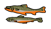
Char at Kuugaaluk
A total of 28 Arctic Char were caught in the river just downstream of the proposed dam site. Most of the fish were likely adults, while nine were likely young fish (less than 35 cm / ~1 foot long).
Arctic Char was the only fish species caught during the sampling.
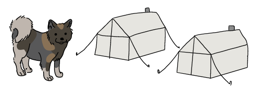
After fish were processed for sampling, the leftovers were fed to camp dog Tikka, to keep her strong and healthy!
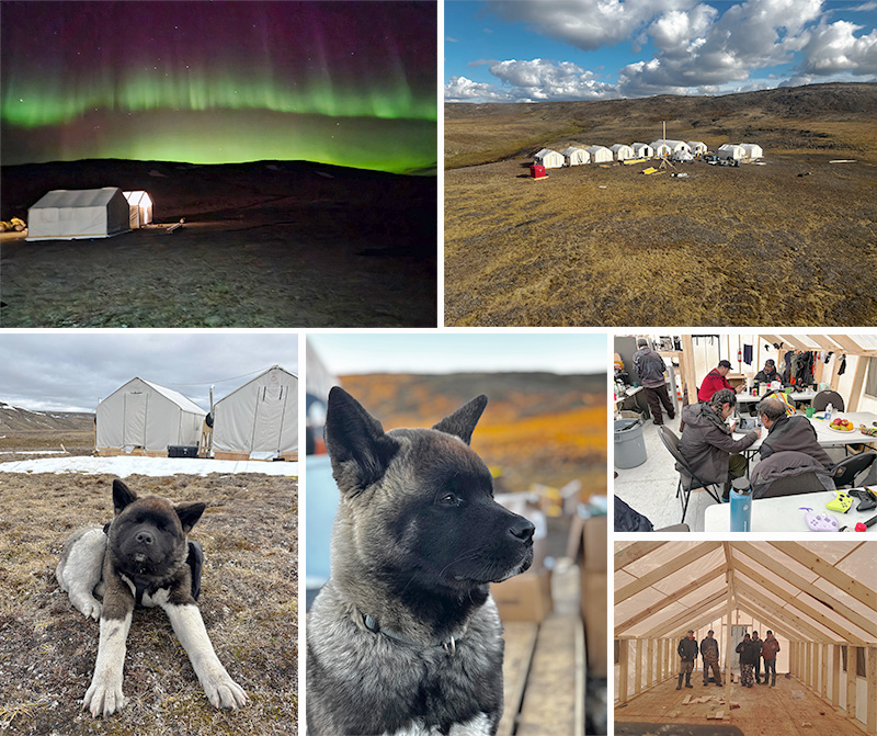
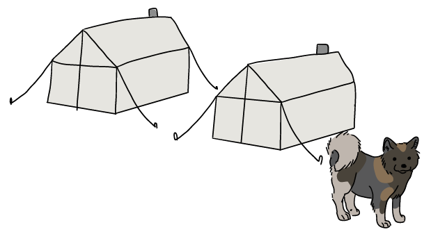
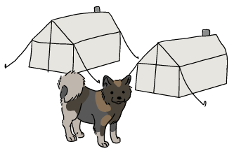
Temporary Camp Life
This is the camp where the field team stayed and worked, complete with sleeping tents, an eating tent, and a work tent. A chef prepared all the meals.
A big part of camp life was Tikka, the camp dog, who patrolled the site, boosted morale during long days, and reminded everyone to enjoy the fresh Arctic air.
Archaeology
The Archaeology Team completed surveys at Kuugaaluk between August 14-28 and September 7-12, 2025, for 19 days in total. The head archaeologist has many years of experience in Nunavut and the Arctic and hired Nunavummiut to help:
- Identify archaeological sites,
- Understand how Inuit used this land in the past,
- Recommend how to protect important cultural places as the project moves forward.
This work was permitted through Nunavut archaeological permit (2025-11A). More surveys of nearby areas will be completed in 2026.
Thank you to our crew and local Inuit knowledge holders who made this work possible.
- Click on the people and equipment to learn what the team did during the field season.
- Click on the magnifying glasses and other objects to see what was found.
- Click outside the text boxes to hide them again.
Kuugaaluk – Qamanialuk
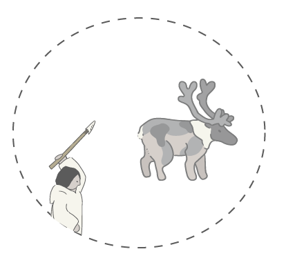
Archaeologists rarely find inland sites in Nunavut, which makes the Kuugaaluk area very special. Most places were used for many activities over long periods, making it hard to know what happened when. But at Kuugaaluk, the evidence and oral history point to one main purpose: Qamanialuk — “the place where Inuit go to kill caribou for caribou parkas”.
Because everything found in this area relates to this same activity, it gives archaeologists a rare chance to study this part of Inuit history.
Archaeology Team
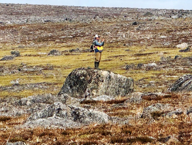
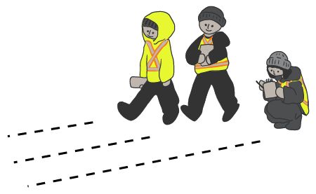
A team of seven people walked together in a line across the entire reservoir area, section by section. They carefully scanned the ground, looking for cultural features.
Getting Around Kuugaaluk
The archaeology crew traveled to the survey area each day by helicopter, (and sometimes by boat), depending on the location they needed to reach.
Making Records
The team took photos of each feature they found and recorded its GPS location. They wrote down what the feature was (e.g. tent ring or marker stone) and its condition. When possible, the team also recorded the age or cultural group they thought the site may belong to.
The ground around each feature was checked for artifacts or animal bones. Nothing was collected, changed, or disturbed.
Good Caribou Hunting
The Archaeologist believes this area was used for an annual caribou hunt, based on what was observed. This was likely a short, seasonal trip in late summer, when caribou hides were best for making warm parkas. The hunters were probably Inuit "Walkers" who travelled from the Cumberland Sound area.
The current hypothesis is that the sites date from about 1200 to 1850; the late precontact period of the Traditional Inuit. This is because no artifacts or features from earlier Palaeo-Inuit times, or from later Thule or Historic Inuit periods, were found.
Archaeological Sites
A total of 61 archaeological sites were found across a very large area at Kuugaaluk — about 100 square kilometres (almost twice the size of Iqaluit).
The number of sites found from place to place in Nunavut can be very different. In this area, the pattern suggests people used it seasonally, not all year round.
Even though there aren’t many sites, the ones that were found are very well preserved. Most features are still in good shape, except for a few marker stones that have tipped over. The tent rings, especially those built with big, heavy rocks, are still easy to see on the land.

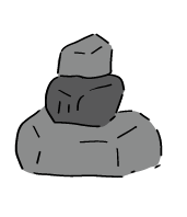
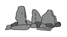
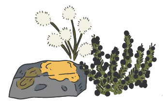
Marker Stones
Marker stones were the most common archaeological feature found in the study area, making up almost half of all the features observed.
A marker stone is an arrangement of rocks, boulders or stones (piled, in a line, etc.) placed on the land to share important information. Inuit used them to show safe travel routes, good hunting, or places to avoid. Hunters also used makers stones to help guide their way on long trips.
Some of the marker stones here may have marked a trail or formed a line, guiding caribou toward a place where hunters could safely and quickly harvest them.
None of the marker stones had any artifacts, bones, of other features beside them.
Tent Rings
Tent rings were the second most common feature found.
A small, undisturbed tent ring on top of a boulder was also found. The Archaeologist thinks this might have been a children's playhouse, suggesting that families took part in the summer caribou hunt.
No artifacts were found at any tent rings, and only a few scattered caribou bones were seen.
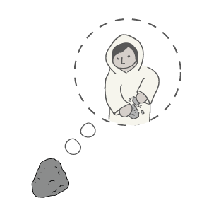
Stone Tools
A stone tool was found near the crew’s camp. One side of the stone has a straight, flat edge where the tool was likely held. On the opposite side, five flakes were struck off, leaving sharp edges about 5 cm long that could have been used as a scraper or knife.
Finding this tool in an area covered by plants suggests that many more tools may be hidden under the vegetation. The Archaeologist thinks this tool was likely made by the Tunnit.
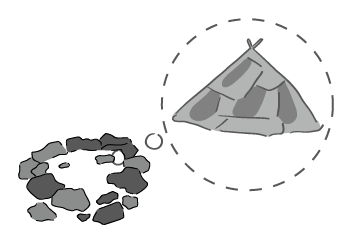
Meat Caches
Several suspected meat caches were found in the study area. A cache is a pile of rocks used to cover and protect harvested meat. Caches can be built against a rock ledge or boulder, on top of a boulder, or in cracks of bedrock covered by flagstones (creating a storage space).
An occasional caribou bone was visible within these caches.
Hunting Blinds
A small number of hunting blinds were found in the study area. A hunting blind is a simple rock wall that a hunter hides behind while waiting for animals to come close.
One blind was built on top of a boulder with a very good view of the land.
The landscape at Kuugaaluk (large boulders and ridges) naturally provides good hiding spots, which is probably why there were so few hunting blinds.
Things We Didn’t See
The archaeologist was surprised that some common archaeological features were not observed in the area, including kayak stands, fox traps, Inukshuks, and qammuks/pit houses.
No human remains or grave features were found in the study area. This is expected because the area was likely only used for short, seasonal caribou hunts.

Temporary Camp Life
This is the camp where the field team stayed and worked, complete with sleeping tents, an eating tent, and a work tent. A chef prepared all the meals.
A big part of camp life was Tikka, the camp dog, who patrolled the site, boosted morale during long days, and reminded everyone to enjoy the fresh Arctic air.
Ground Studies
The Ground Studies Team completed the Phase 1 geotechnical and geophysical surveys between August 26 – September 13, 2025 for a total of 19 days. TetraTech Inc. and Inuit guides learned about the underground materials, such as:
- Depth to bedrock
- Soil and rock types
- Permafrost locations
These studies create a preliminary picture of what lies below the surface in the study areas.
Thank you to our crew and local Inuit knowledge holders who made this work possible.
- Click on the people and equipment to learn what the team did during the field season.
- Click on the magnifying glasses and other objects to see what was found.
- Click outside the text boxes to hide them again.
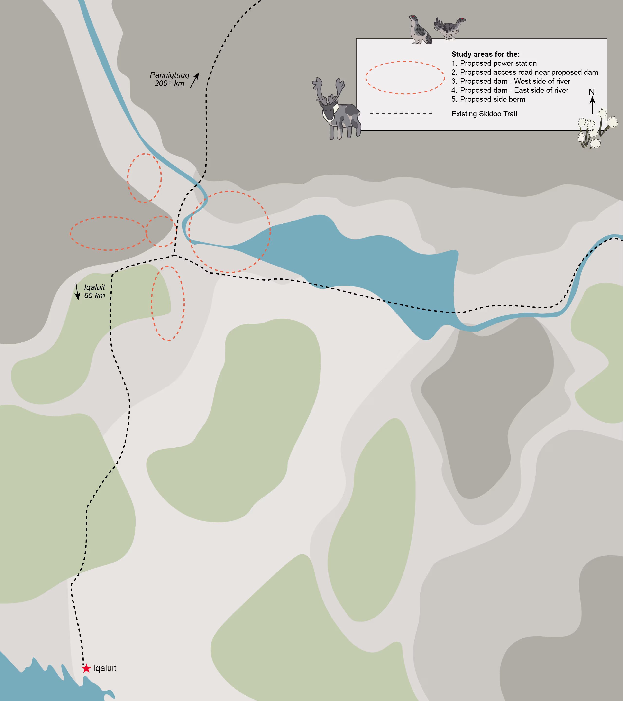
Study Area 1 – Proposed Powerhouse Area
Where We Looked
At the proposed powerhouse site near the river, the ground has cobbles and boulders on the surface. This is called a fluvial terrace (an area shaped by flowing water).
Farther southwest, there is a till zone (made by glaciers) with mixed soil, less plants, with patches of grass and lichen.
What We Found
The active (freeze/thaw) layer is 0.2 – 2.8 m deep. About 54% of the surveyed area is made up of ice-rich zone (ice 2 – 15 m deep).
Why This Matters
Ice-rich zones can shift or sink when they melt, so engineers use this information to plan the strongest foundation for the powerhouse.
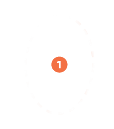
Study Area 2 – Proposed Access Road Area
Where We Looked
This area extends about 1.5 km west of the proposed dam site. The land there is hilly with gravel, cobbles, and boulders on the surface. There are several small water bodies north and south of the road path.
What We Found
The active (freeze/thaw) layer is 1 – 4.3 m deep. About 67% of the surveyed path through this area is believed to be an ice-rich zone (ice 7 – 25m deep).
Why This Matters
Knowing where the ground is strong, or more likely to change (such as ice-rich zones which can shift or sink from melting), will help the engineers plan the safest road route and design strong foundations that can handle changing ground conditions.
Study Area 3 – Proposed Dam, West Side of River
Where We Looked
The proposed dam site on the west side of the Kuugaluk River has hilly terrain with some wet ground and large boulders at the north and south ends of the area.
What We Found
The active (freeze/thaw) layer is 0.9 – 2.5 m deep. About 69% of this area is the ice-rich zone (ice 5 – 21 m deep).
Why This Matters
The ice-rich zone can sink or shift if the ice melts. This information helps engineers design a safe and stable dam foundation.

Study Area 4 – Proposed Dam, East Side of River
Where We Looked
The proposed dam site on the east side of the Kuugaluk River has coarse sand, river cobbles, and large boulders near the riverbanks. Further from the river, the land is made of moraine till (mixed sand, gravel, and cobbles, left behind by glaciers) with several small streams flowing across it.
What We Found
The active (freeze/thaw) layer is 11 – 45 m deep. About 49% of this area is ice-rich ground (ice 4 – 44 m deep).
Why This Matters
The ice-rich zone can become weak or unstable if the ice melts. This information helps engineers design a safe and stable dam foundation.

Study Area 5 – Proposed Berm Area
Where We Looked
About 650 metres southwest of the proposed dam, there is a low area near the road that may need a berm (a built-up barrier) to prevent flooding when the reservoir is created. In this area:
- The ground is wet and soft with scattered boulders in the north
- There’s a boulder field in the south
- There’s a small creek running east to west between the north and south areas
What We Found
The active (freeze/thaw) layer is 1.2 – 3.9 m deep). About 32% of the survey area has and ice-rich zone (ice 3 – 15 m deep).
Why This Matters
If the ice melts, the ground can sink or weaken, so this information helps engineers decide where a berm is needed and how to build it safely. A berm is a like a human-made hill that can help keep water inside a reservoir.

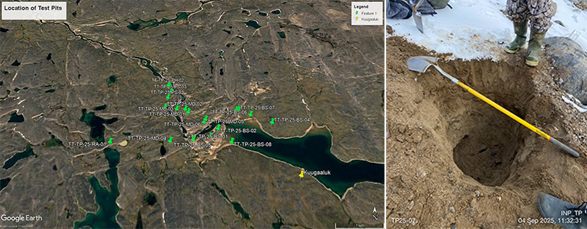
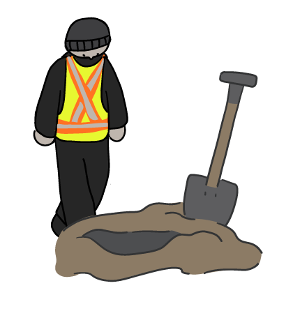
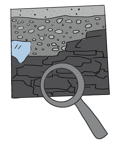
Digging Test Pits
Scientists dug 20 small holes in the ground up to 1.2 metres deep, called test pits.
They looked closely at the soil and rock in each test pit and recorded their observations. They also measured the temperature of the permafrost.
Soil samples were collected and sent to the laboratory for more detailed testing.
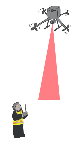
LiDAR Mapping
The team ran drone flights in the fall of 2024 to complete a LiDAR survey of the entire project area (including the access road), to provide high-resolution maps of the terrain.
During field season 2026, they ran five extra drone flights to get even better quality LiDAR data for studying target areas, such as the potential rock quarry and the bedrock canyons along the river.
LiDAR stands for Light Detection and Ranging. It’s a tool that uses lasers to measure the shape of the land from above. LiDAR creates very detailed 3-D maps that help the team understand the terrain, slopes, and surface features.
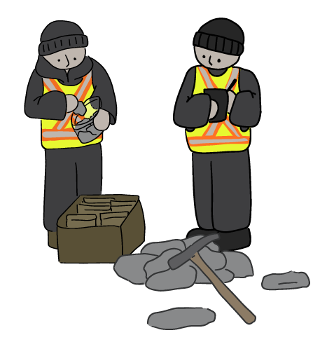
Bedrock Sampling
Three bedrock samples were taken from the proposed rock quarry location. The samples were sent to a laboratory to see if they might release acid into the environment when they are broken or exposed to air and water.
This is because some rocks contain minerals that can create acid when they react with oxygen. This acid can harm plants, animals, and water quality.
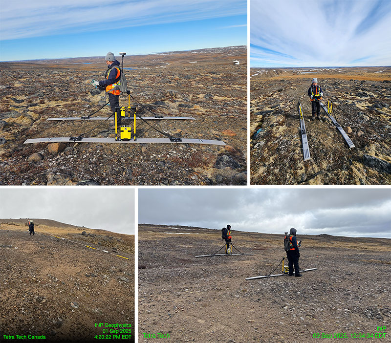
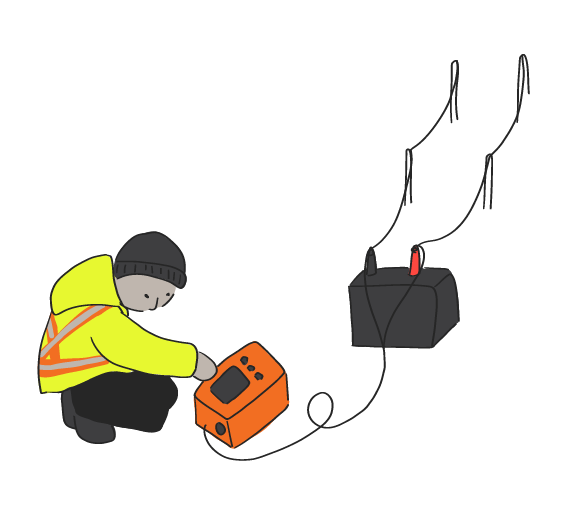
Seeing Underground with Geophysical Tools
Ground Penetrating Radar (GPR) data was collected in five locations:
- Proposed powerhouse location
- Access road near proposed dam
- Proposed dam area on river’s west side
- Proposed dam area on river’s east side
- Proposed reservoir berm area (may be needed)
GPR is a geophysical survey method that helps "see" underground without digging. It sends pulses of radar energy into the ground using an antenna and measures the signals that bounce back. Different types of soil, rock, or water reflect the radar differently, creating a picture of what is below the ground surface.
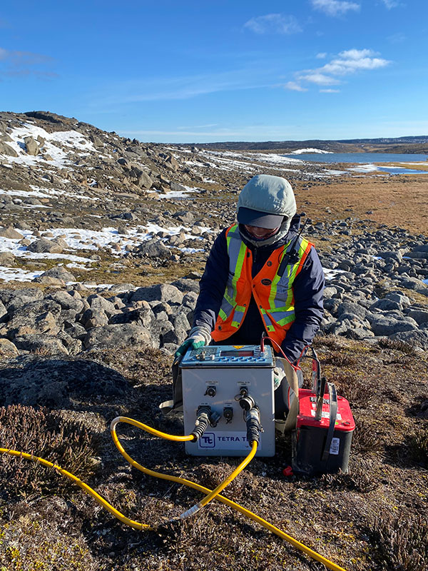
Mapping Underground Layers with Electricity
Electrical Resistivity Tomography (EMT) data was collected in the proposed dam location only, along both the west and east sides.
EMT is a geophysical survey method that helps scientists “look” underground by measuring how easily electricity flows through the soil and rocks. Different materials—like water, ice, clay, or rock—conduct electricity differently, so EMT can create a picture of what’s beneath the surface.
A series of 96 electrodes are temporarily driven into the ground, 30 cm deep and 5m apart, all in a line. The electrodes are attached to cables that run to a central unit that collects and records the data.
Ground Surface at Kuugaaluk
The ground materials found are mainly as follows.
- Low-lying areas: bedrock, silt and clay in low lying areas,
- Moraines: sand and gravel
- Lake Shore: sand
Moraines were formed long ago by glaciers. As glaciers moved, they pushed and dropped piles of rocks, sand, and gravel. When the ice melted, these piles were left behind as long ridges or mounds on the land.
Safe Planning
Using tools to "see" up to 75 metres underground, engineers and geologists can learn:
- How deep the active layer (freezes and thaws each year) and the bedrock are
- Drainage features in the soil
- Where ice layers are and how thick they might be
- Ice-rich zones which have broken ice and ice layers.
- Underground soil types
This information lets engineers safely plan the dam, roads, and foundations so they stay strong over time.
NOTE: Ice-rich zones are not the same as permafrost, which is defined by temperature (frozen for 2+ years), not by how much ice is present. The information gathered using these tools does not comment on permafrost.
Temporary Camp Life
This is the camp where the field team stayed and worked, complete with sleeping tents, an eating tent, and a work tent. A chef prepared all the meals.
A big part of camp life was Tikka, the camp dog, who patrolled the site, boosted morale during long days, and reminded everyone to enjoy the fresh Arctic air.
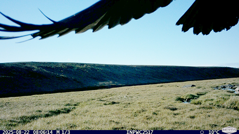
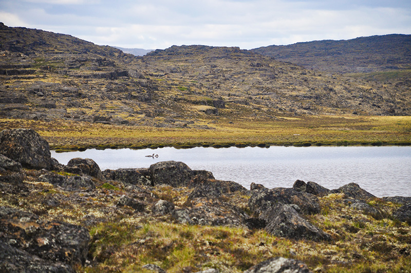
Wildlife & Terrestrial
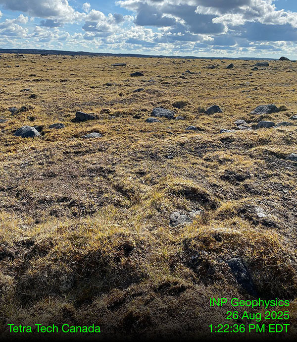
The Wildlife and Terrestrial team completed surveys at Kuugaaluk between August 9 – 25, 2025 and September 8 – 12, 2025, for a total of 22 days. EcoLogic Consultants Inc. and Inuit guides collected early information about wildlife, plants, and ecosystems in and around the proposed project area.
The information collected will help plan future fieldwork and show us how a water power project could affect the land, water, plants, and animals, and how those changes can be avoided or reduced.
Thank you to our crew and local Inuit knowledge holders who made this work possible.
- Click on the people and equipment to learn what the team did during the field season.
- Click on the magnifying glasses and other objects to see what was found.
- Click outside the text boxes to hide them again.
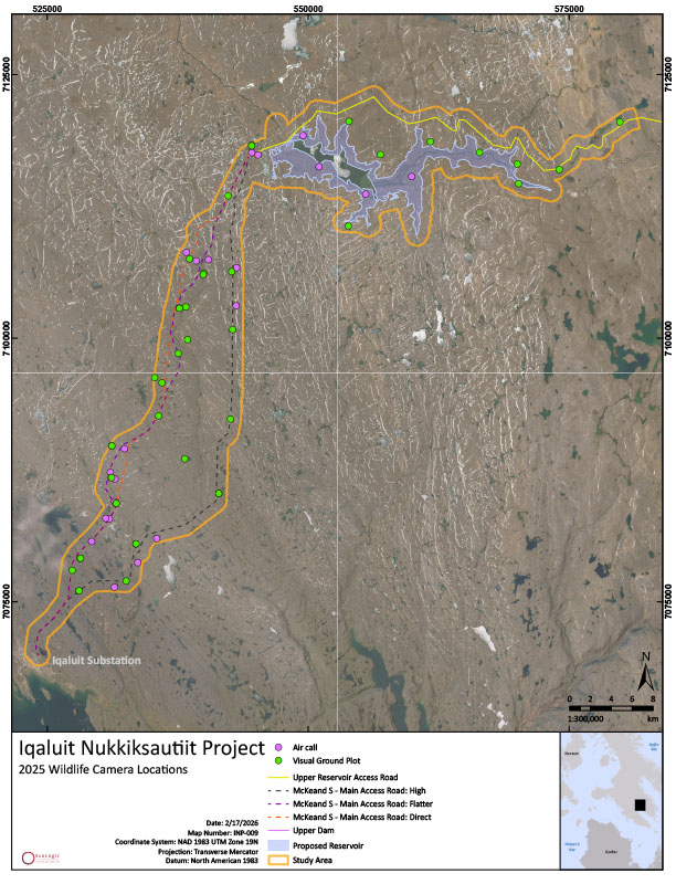
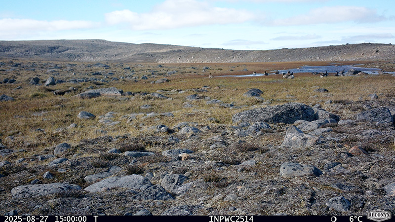
Wildlife Camera Network
A network of 39 wildlife cameras were carefully set up to learn which animals use the area:
- 20 along the proposed access road
- 8 along the river, downstream of the lake
- 11 around the proposed reservoir
Camera locations were first chosen using satellite images and then adjusted in the field based on the landscape and animal habitats seen from the helicopter.
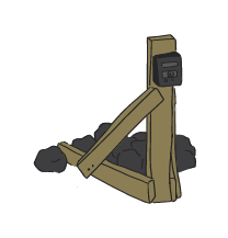
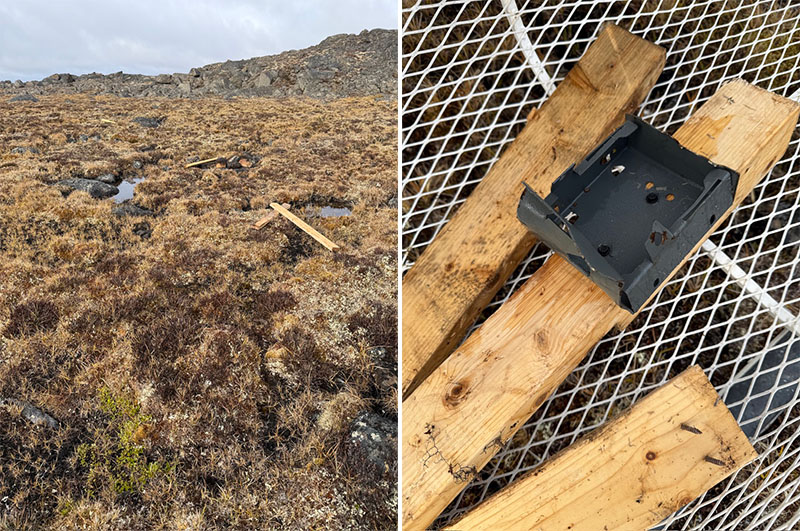
Itchy Antlers!
One of the wildlife cameras was damaged by caribou rubbing their antlers on the stand. We know the cameras did not scare the caribou away!
Ecosystem Land Classification
One goal of the 2025 field season was to gather information for creating an Ecosystem Land Classification (ELC) map. An ELC map divides the whole area into smaller pieces, and groups them into different ecosystem types, based on:
- Plants
- Animals
- Soil and ground conditions
- Landforms like hills or valleys
- Water (streams, ponds, wetlands, or dry areas)
- Micro-climate
By studying these features, we can see where different types of nature are found and how common those types are. This helps us protect the land and understand how the project might affect the environment.
ELC Map Making
Scientists are creating the final ELC map using data from:
- 2025 ground plots (observations from walking the land)
- 2025 air call plots (observations made from helicopter)
- High-resolution LiDAR (2025 surveys)
- Infrared images available on the internet
- Other available satellite imagery
- Field data collected in 2026 to confirm accuracy
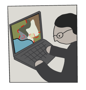
Click on Ecosystem Land Classification to learn more.
Looking at the Land – Contributing to ELC mapping
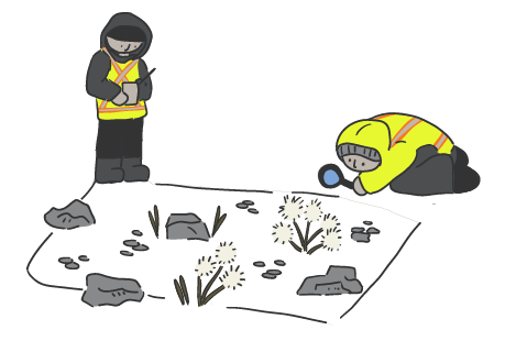
Scientists studied 34 ground plots by walking on the land.
These ground plots will be used to help create the ELC map of the study area. At each plot:
- A 400 m² was marked
- Plants, terrain, and signs of wildlife were recorded
- Notes were taken about which ELC type the plot belonged to.
Click on Map Making and Ecosystem Land Classification to learn more.
Looking From Above – Contributing to ELC mapping
Scientists studied 80 air call plots from above ground in a helicopter.
These air call plots will be used to help create the ELC map. At each air call plot the team took notes on:
- The tundra
- Bedrock
- Wetlands
- Riparian areas (next to streams or rivers).
Click on Map Making and Ecosystem Land Classification to learn more.
Walking the Land
Scientists completed 29 wildlife transects:
- 5 along the downstream river / near the proposed reservoir
- 24 along the area of the proposed access road routes
For each transect, the field crew walked a 1 km straight line and recorded what they saw. They looked for birds and mammals, and signs of wildlife, such as:
- Tracks
- Scat
- Feathers
- Fur
- Antler sheds
- Animal trails
This work gives early information about which animals use the area and will guide the planning of the 2026 field season.
Staying Alert
If wildlife or any signs of wildlife were seen or heard outside the main study areas, the crew still recorded them.
These extra notes help give a better overall picture of how wildlife uses the land around the study area.
LiDAR – Contributing to ELC Mapping
A very detailed map of the entire project area was completed using LiDAR.
LiDAR, which stands for Light Detection and Ranging, uses lasers to measure the shape of the land from above. This creates high-quality 3D maps of the ground.
Arctic UAV, a company based in Iqaluit, flew drones over the area with the LiDAR equipment attached.
The LiDAR map and images will contribute to creating the ELC maps.
Click on Map Making and Ecosystem Land Classification to learn more.
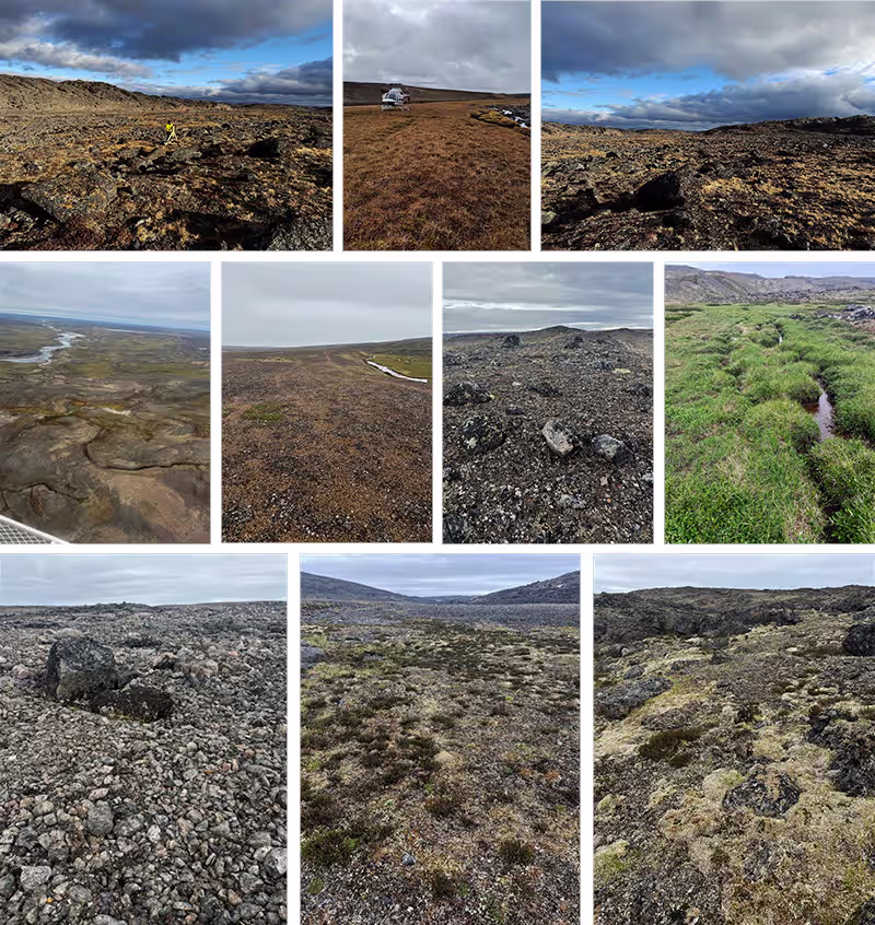
Types of Nature - ELC
The visual ground plots helped identify 10 preliminary ecosystem types in the project area:
- Barren (Till)
- Bedrock
- Dry Sparse Tundra
- Fellfield Tundra
- Heath Heather Tundra
- Till Graminoid Tundra
- Graminoid Tundra
- Glaciofluvial
- Riparian
- Tundra Tussock
Click on Map Making and Ecosystem Land Classification to learn more.
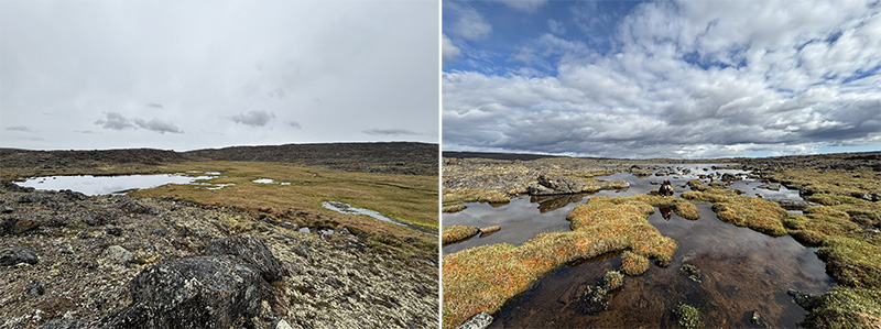
Bird Habitat
Several waterfowl staging areas were found in wetlands along the southern parts of the proposed access routes.
These are places where birds like ducks and geese rest, feed, and gather before continuing their migration.
Feathers and droppings show that many birds, likely hundreds, use these wetlands, making them important habitat areas to protect.
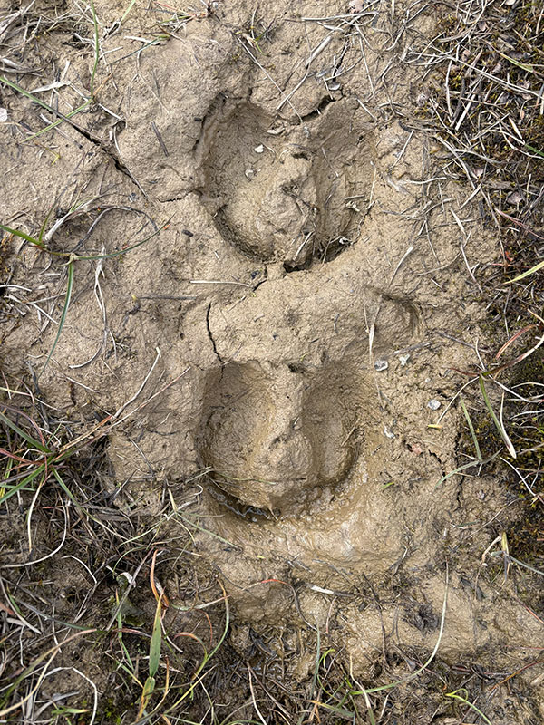
Caribou Trails
All three proposed access road routes cross established caribou trails. These trails show signs of historic use (well-worn paths) and recent use (fresh hoof prints and droppings).
This tells us that caribou still travel through the area, so careful planning must help protect their routes.
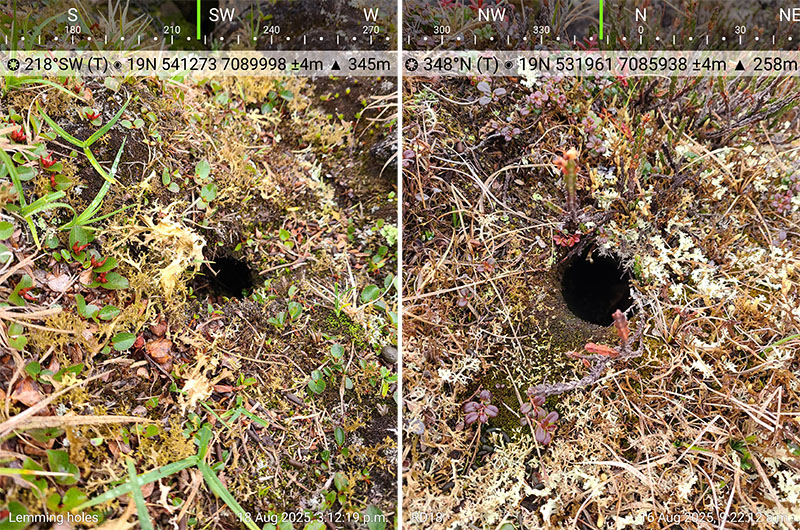
Lemming Burrows
Spotted in several places.

Animals at Kuugaaluk
A total of 19 different wildlife and bird species were observed during the field season. Caribou were seen most often. Canada Geese and Arctic Fox were also fairly common in the area.
Only a few sightings were made of other species, such as Raven (2 sightings) and Red Fox (1 sighting).
These observations help us understand which animals use the land now and will guide future wildlife studies.

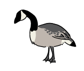
Canada Geese
Seen along the access roads and near the reservoir shoreline.
From the camera photos taken over 31 days, Canada Geese were detected on nine different days across the whole camera network.
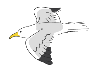
Big Birds
Glaucous Gull, Gyrfalcon, and Herring Gull were all observed at various locations of the study site.
Arctic Songbirds
American Pipit, Lapland Longspur, Horned Lark, and Snow Bunting were all observed at various locations of the study site
Ravens
Observed along all three access road route options.
From the photos taken over 31 days, Ravens were detected on 2 days within the entire camera network.
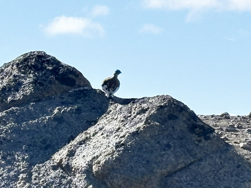
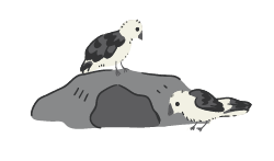
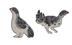
Ptarmigan
Observed at the reservoir shoreline, towards the lake upstream from Kuugaaluk, and in the proposed access road area (high elevation route option).
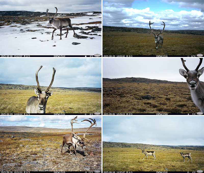
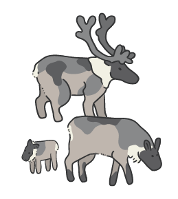
Caribou
Seen along the lake shoreline at Kuugaaluk and along the area of the proposed access road routes.
From photos taken over 31 days, caribou were detected on 28 days across the entire camera network.
These Caribou are part of a group called Barren-ground Caribou. In 2016, Canadian wildlife experts listed them as “Threatened” because there are fewer of them left now than in the past. This means they could become endangered if their numbers keep falling and they are not protected. This designation has not been finalized by the Species at Risk Act (SARA).
At this time, the Government of Nunavut does not support listing these Caribou as Threatened in Nunavut because there are strict wildlife management systems and co-management plans already in place in the territory.
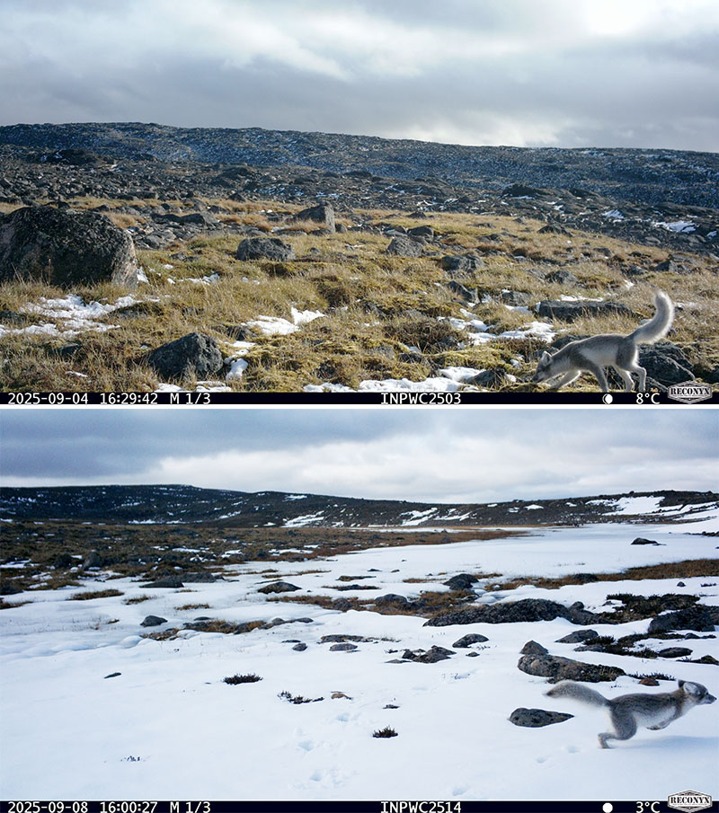
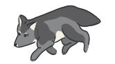
Arctic Fox
From photos taken over 31 days, Arctic Fox were detected on 15 days across the entire camera network.
Tracks were seen along the shoreline of the proposed reservoir.
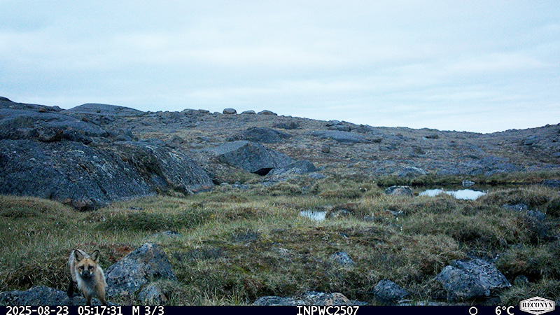
Red Fox
One was detected one time along the proposed high-elevation access road route.

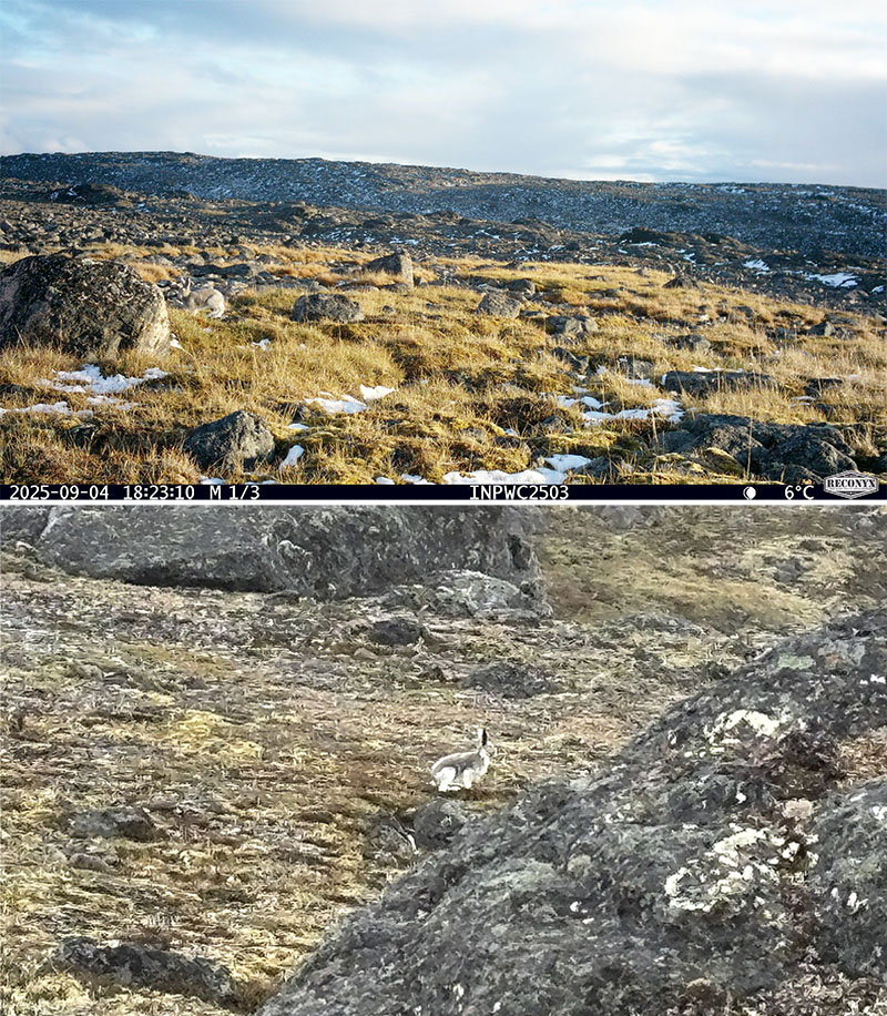
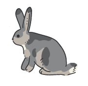
Arctic Hare
From photos taken over 31 days, Arctic Hare were detected on 4 days across the entire camera network.
Their droppings were observed along one of the access road options.
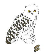
Snowy Owl
Pellets were found along the lake shoreline and on two of the access road routes.
The Snowy Owl is part of a group that was listed as “Threatened” by Canadian wildlife experts in 2016. This means there are fewer of them now than before, and they could become endangered if not protected.
Because the listing under the Species at Risk Act (SARA) has not yet been finalized for Nunavut, the protective status is not official.
Weasel
One was seen near one of the access road options.
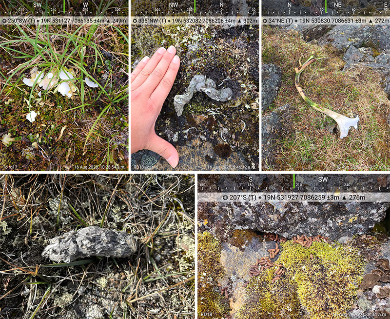
Animal Clues
Droppings from Arctic Hare, Canada Goose, Barren-ground Caribou, and Lemming were found in different places across the study area.
Scat from a Canidae (a member of the dog family — possibly a wolf, fox, or dog) was also found but could not be identified to the exact species.
Caribou fur was observed.
Snow Bunting and Canada Geese feathers were found at various locations.
Barren-ground caribou antler sheds were found.
Arctic Fox tracks were spotted around the proposed reservoir shoreline, and Barren-ground Caribou tracks were observed along caribou trails in the access road areas.
Lemming trails were seen in the proposed project site area and the access road areas.
Loons
The common loon and red-throated loon were observed along the proposed access road options.
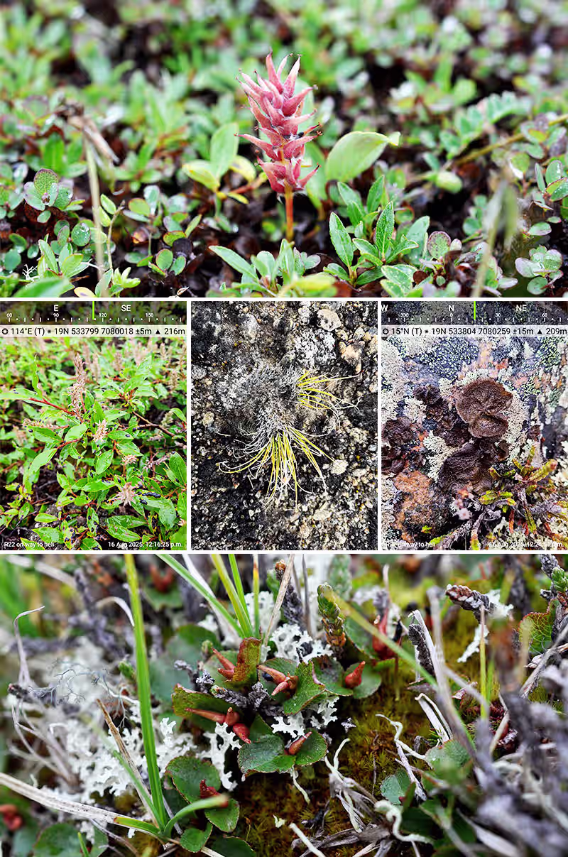
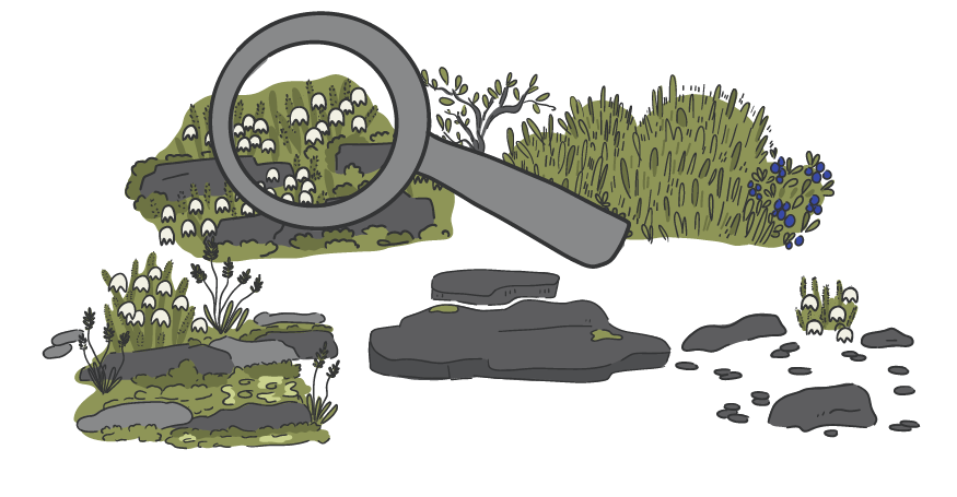
Common Plants
The most common plants observed were:
- Arctic bell-heather (Cassiope tetragona), a small evergreen shrub. Found in 20 of the plots
- Bigelow's sedge (Carex bigelowii), a type of sedge. Found in 18 of the plots
- Mosses and lichens such as Wolly Moss (Racomitrium lanuginosum) and Reindeer Lichen (Flavocetraria sp.). Found in 12 and 11 plots respectively
- Small willows, especially Arctic Willow (Salix arctophila) and Snow/Dwarf Willow (Salix herbacea). Found in 10 and 11 plots respectively
These plants are very typical of cold Arctic environments, shallow soils, and rocky land.
Click on Looking at the Land to learn more.
Temporary Camp Life
This is the camp where the field team stayed and worked, complete with sleeping tents, an eating tent, and a work tent. A chef prepared all the meals.
A big part of camp life was Tikka, the camp dog, who patrolled the site, boosted morale during long days, and reminded everyone to enjoy the fresh Arctic air.